Public Access Birding Sites in Fentress County, Tennessee
If you have information about other public access birding sites in this county, please send details to me at this e-mail address:
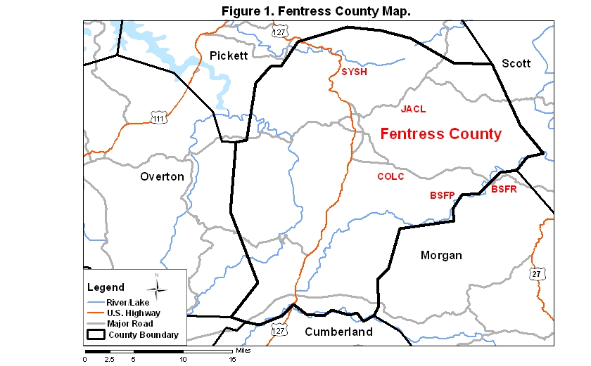
Fentress County covers an area of 1292 km2 (499 mi2). A map of the county—with the some sites noted below coded on it—is available via the following link:
Colditz Cove Pocket Wilderness (COLC) is a small public access site in Fentress County that is worth an occasional visit. To get to this site, go to the intersection of Rts. 52 and 296 in Allardt; then go east 1.2 miles on Rt. 52 to Northrup Falls Rd. on the right; take this road 0.9 miles to the trailhead for Colditz Cove on the right. There is a short loop trail to the major features of this site; the trail is about a mile long. Many very large white pines are found at this site, making it attractive to conifer-loving species both winter and summer. On the way in to the parking lot, there is a very small transient pond on the left about 0.1–0.2 miles from Rt. 52; if wet, this pond is worth checking for shorebirds during migration.
The Peters Bridge (BSFP) canoe access point on Clear Fork in the Big South Fork National River and Recreation Area lies partly in Fentress County. To get to this site, take Rt. 52 east 4.3 mi from the same site in Allardt (described above) and go right on Peters Ford Rd. 4.5 mi where a boundary sign for the BSFNRRA will be seen. About 0.2 mi of this road runs through the BSFNRRA on the west side of the bridge (another 0.6 mi of the road is in the BSFNRRA, Morgan Co., on the east side of the bridge). This is a good site to hear and occasionally to see Ruffed Grouse. The canoe trip down to Rugby Bridge is about 6 miles long and very placid with good birding opportunities, especially in spring and early summer. Be sure to check the flow rate before trying this stretch of river; if the gauge at Burnt Mill Bridge is reading 400 cfs, then you have enough water for this part of the river, but it can be run much higher, though birding opportunities go down as the water and water noise go up.
The Rugby Bridge (BSFR) over Clear Fork is also part of the BSFNRRA. It lies about 9 miles east of Allardt and 1.5 mi west of Rugby (in Morgan County). A road to the canoe access point goes south from Rt. 52 about 0.6 mi west of the stupefyingly high bridge over Clear Fork. This access road is 0.9 mi long; there is a picnic area on the right on the way down to the river. This site offers moderately good birding opportunities in spring and early summer.
The Sergeant York State Historic Site (SYSH) at Pall Mall on Rt. 127 at the Wolf River offers opportunities to bird near a small impounded lake, along the Wolf River, and within wooded picnic areas and play areas. Besides the old grist mill, which harbors an occasional phoebe nest, the site offers fair birding opportunities during most days except when heavy tourist use occurs (i.e., holidays and some week-ends).
Jamestown City Lake (JACL) is a small public access site located east of Jamestown; the lake, which provides the water supply for that town, is about 50 acres in extent and sometimes harbors waterbirds that are worth a look. Get to this site by taking the Rt. 127 bypass east around Jamestown; get off on Hwy. 52E (BP Station near this intersection) and go east about 0.5 miles to Round Mountain Rd. on the left; take it and go 3.0 mi; then turn left onto City Lake Rd. This sometimes steep gravel road dead-ends in about 1.5 mi. (avoid this road in wet weather if you do not have four-wheel drive). Walk down to the lake near the boat ramp and look around. Most of the lake cannot be seen from the end of the road or the boat ramp, so a canoe or boat would help in birding the site.
Please send details about any birds you record in these parks—or any public access site in Fentress Co.—to me at the e-mail address noted above. sjs.
Quick links to other sections of this website: