Public Access Birding Sites in Clinton County, Kentucky
If you have information about other public access birding sites in this county, please send details to me at this e-mail address:
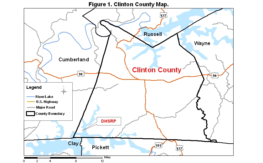
Clinton County covers an area of 532 km2 (205.5 mi2). A map (Figure 1) of the county—with the some sites noted below coded on it—is available via the following link:
Dale Hollow State Resort Park (DHSRP) is one of the better birding sites in Clinton Co., KY (and Cumberland Co., KY). To reach this fairly remote park, take Rt. 53 north from Celina, Tennessee, or Rt. 61 south from Rt. 90 in Burkesville, Kentucky, to Rt. 449 going east; in 1 km (0.5 mi) go left, staying on Rt. 449, and in 8 km (5 mi) go south on Rt. 1206, which ends in the park. The park may also be approached via Rt. 90 and Rt. 449 from the east.
The most important birding trail in the park is the Eagle Point Trail, accessible from the main road in the park or from the side road that leads to the Mary Ray Lodge. This trail crosses the main park road about halfway between the side road to the lodge and the boat ramp at the end of the road; if driving toward the boat ramp, the trail goes off to the right (south), beginning and remaining mostly in Cumberland County but ending in Clinton County near Eagle Point. At the end of the trail a magnificent overlook offers extensive views of Dale Hollow Lake, probably the best panoramic views of this lake that can be found anywhere in Kentucky or Tennessee. A variety of habitats are traversed along the trail, starting with field habitat near the main road, continuing through some shrub-scrub habitat, and ending in fairly mature mixed forest habitat about halfway out to the point. This variety makes it possible to record a diverse array of species along this short—1.6 km (1 mi)—trail; it is especially good to walk during either of the migration seasons when many migrant passerines are mixed in with the local breeding species. If you want a slightly longer hike, you may walk to the point from the side road to the lodge, using the Boom Ridge-Eagle Point Connector Trail. There is less field habitat and less shrub-scrub habitat, and more mixed forest habitat, by going this way. The overlook offers a good opportunity to view raptors and waterbirds; a telescope is useful if you are willing to carry it to the overlook.
Another nice trail for woodland birding is the Ranger Loop Trail; it is about 2.5 km (1.7 mi) long and includes a little shrub-scrub, as well as woodland, habitat. You may access this trail from the campground.
The park trail that leads southwest from the Mary Ray Lodge is the Boom Ridge Trail. It actually extends south into Tennessee at its terminus; a number of dead-end side trails branch off from this main trail, so it is possible to spend half a day birding and hiking in this part of the park, which is dominated by mixed forest and deciduous forest habitats. Again, during migration these trails provide access to many species of migrant passerines.
The boat ramp at the end of the main park road is a good place to check for waterbirds, and it is the place to meet the Corps of Engineers' barge for eagle tours in winter.
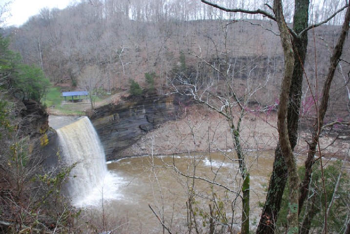
A small public access site controlled by the Corps of Engineers is Seventy-Six Falls, located on Rt. 3062 about 4 km (2.5 mi) north of where Rt. 127, coming from the south, intersects Rt. 90. This 50-foot falls is quite spectacular when there is a good flow of water over it. Birding in the site is limited by its small size and to some extent by water noise if the falls is running much. Louisiana Waterthrushes are present from late March through July of most years.
|
|
| View of Seventy-Six Falls during early April 2008; photo SJS. For scale, note the picnic shelter just above the falls. |
Please send details about any birds you record in these areas—or any public access site in Clinton Co.—to me at the e-mail address noted above. sjs.
Quick links to other sections of this website: