Cerulean Warbler (Setophaga cerulea) Surveys in Western Putnam County, Tennessee, 2004–Present
In an effort to monitor the breeding population of Cerulean Warblers in western Putnam County, Tennessee, I have conducted a nonstandard driving survey for over a decade (2004–2019), and I conducted 50 standard point counts during a six-year portion of that interval (2007–2012). A summary of the results for the years of overlap follows (Note: the data from the Driving Route appear to indicate a considerable increase in the Cerulean Warbler population during the years from 2007 to 2012, but such an increase is not as clear-cut if all data collected during the years of the Driving Route are examined [see Tables 2 and 3], and in any case the apparent increase in Cerulean Warbler numbers counted along the Driving Route during 2007–2012 is not supported by data from the concurrent 50 Point Counts).
Table 1. Comparison of Results from a Driving Survey and 50 Point Counts in Western Putnam County, Tennessee; the Driving Route Passes by 38 of the 50 Point Count Locations.
| Year | Cerulean Warblers Counted during Driving Route (50 mi in 6–8 hours) | Cerulean Warblers Counted on 50 Points (10 minutes each = 8 hrs., 20 min) |
| 2007 | 28 (20 May) | 33 (5–8 June) |
| 2008 | 36 (20 May) | 20 (4–11 June) |
| 2009 | 40 (20 May) | 25 (21–28 May) |
| 2010 | 53 (20 May) | 29 (22–25 May) |
| 2011 | 49 (20 May) | 25 (18–22 May) |
| 2012 | 60 (20 May) | 35 (19–26 May) |
For 16 years I have conducted a nonstandard driving survey for Cerulean Warblers in western Putnam County, Tennessee.The survey route is about 81 km (50 mi) long and covers many roads that traverse the escarpment (elevation 198–320 m [650–1050 ft]) that separates the Central Basin (elevation 152–198 m [500–650 ft]) from the Highland Rim (320–381 m [1050–1250 ft]); see the directions at the bottom of this page for details about the route. In Table 2 (below), one asterisk (*) denotes a road surveyed while driving down the escarpment, and two asterisks (**) denote a road surveyed while driving up the escarpment. This escarpment and areas close to it harbor a fairly dense population of Cerulean Warblers that is subject to monitoring using a fairly simple protocol.
I drive at 15–25 km/h with car windows down, looking for, listening for, and counting all species of birds, but in particular Cerulean Warblers, seen and (mainly) heard as I drive. When Cerulean Warblers or other species of concern are heard or seen, I stop and spend extra time (usually 1–2 minutes, but occasionally up to 10 minutes) in the area obtaining a careful count of Cerulean Warblers and all other species. Data are recorded on a field card, individual by individual. Little traffic is present on most of the back roads I cover during the survey.
Table 2A. Number of Cerulean Warblers (CERW) counted on 28 sections of an 81-km survey route in western Putnam County, Tennessee.
| Section | Section Length (km) | CERW 2004 | CERW 2005 | CERW 2006 | CERW 2007 | CERW 2008 | CERW 2009 | CERW 2010 | CERW 2011 | CERW 2012 | CERW 2013 | |
| Date in May | 20 | 19 | 19 | 20 | 20 | 20 | 20 | 20 | 20 | 20 | ||
| Start CDT | 0545 | 0540 | 0545 | 0548 | 0541 | 0547 | 0538 | 0535 | 0526 | 0538 | ||
| End CDT | 1545 | 1320 | 1317 | 1240 | 1159 | 1223 | 1223 | 1235 | 1322 | 1355 | ||
| Duration (Hrs.:Min) | 10:00 | 7:40 | 7:32 | 6:52 | 6:18 | 6:36 | 6:45 | 7:00 | 7:56 | 8:17 | ||
| Observer | SJS+ | SJS+ | SJS+ | SJS | SJS | SJS | SJS | SJS | SJS | SJS | ||
| 1 | Bryant Ridge Rd. | 2.82 | 1 | 0 | 0 | 1 | 0 | 1 | 2 | 3 | 1 | 2 |
| 2 | Broadwater Branch Rd. * | 3.78 | 5 | 2 | 3 | 3 | 5 | 4 | 5 | 2 | 8 | 6 |
| 3 | Martin Creek Rd. ** | 2.89 | 6 | 7 | 3 | 4 | 6 | 2 | 6 | 4 | 4 | 6 |
| 4 | Jess Rodgers Rd. | 1.04 | 1 | 3 | 3 | 1 | 0 | 1 | 2 | 6 | 4 | 6 |
| 5 | Martin Creek Rd. cont. | 1.61 | 0 | 0 | 0 | 0 | 0 | 0 | 0 | 5 | 0 | 0 |
| 6 | Carrington Hollow Rd. * | 3.22 | 6 | 3 | 0 | 1 | 1 | 2 | 3 | 2 | 8 | 6 |
| 7 | Brown Hollow Rd. | 0.80 | 2 | 3 | 1 | 1 | 1 | 2 | 3 | 0 | 1 | 1 |
| 8 | Carrington Hol. Rd. cont. | 2.33 | 5 | 4 | 3 | 1 | 2 | 0 | 1 | 3 | 2 | 3 |
| 9 | Martin Creek Rd. cont. | 4.02 | 6 | 2 | 0 | 1 | 4 | 1 | 9 | 3 | 4 | 5 |
| 10 | McBroom Branch Rd. ** | 6.92 | 3 | 1 | 5 | 2 | 6 | 4 | 3 | 1 | 6 | 7 |
| 11 | Maddux Ridge Rd. | 1.21 | 0 | 0 | 0 | 0 | 0 | 0 | 0 | 1 | 0 | 0 |
| 12 | Indian Creek Rd. * | 3.62 | 1 | 1 | 1 | 1 | 0 | 7 | 3 | 5 | 3 | 3 |
| 13 | Tightfit Rd. **/* | 2.09 | 1 | 3 | 2 | 1 | 1 | 2 | 2 | 4 | 2 | 2 |
| 14 | Indian Creek Rd. cont. | 1.29 | 1 | 2 | 1 | 1 | 1 | 4 | 1 | 0 | 3 | 2 |
| 15 | Anderson-Carr Rd. ** | 1.37 | 0 | 1 | 2 | 3 | 1 | 2 | 2 | 1 | 1 | 1 |
| 16 | Carr Ridge Rd. | 2.97 | 1 | 1 | 1 | 2 | 2 | 2 | 3 | 3 | 3 | 2 |
| 17 | Hopewell Rd. * | 6.11 | 3 | 3 | 1 | 3 | 3 | 1 | 2 | 2 | 3 | 1 |
| 18 | Indian Creek Rd. cont. | 4.99 | 1 | 0 | 0 | 0 | 0 | 0 | 0 | 0 | 2 | 0 |
| 19 | Stanton Rd. ** | 4.51 | 0 | 1 | 0 | 1 | 0 | 0 | 2 | 0 | 0 | 0 |
| 20 | Little Indian Creek Rd. * | 5.69 | 2 | 0 | 0 | 0 | 3 | 2 | 1 | 3 | 1 | 0 |
| 21 | Ensor Hollow Rd. ** | 4.66 | 1 | 5 | 2 | 1 | 0 | 2 | 3 | 1 | 2 | 1 |
| 22 | Rock Springs Rd. * | 4.50 | 0 | 0 | 0 | 0 | 0 | 1 | 0 | 0 | 1 | 1 |
| 23 | St. Mary's Rd. | 0.88 | 0 | 0 | 0 | 0 | 0 | 0 | 0 | 0 | 0 | 0 |
| 24 | Bates Rd. | 1.60 | 0 | 0 | 0 | 0 | 0 | 0 | 0 | 0 | 1 | 0 |
| 25 | Rt. 96 | 2.73 | 0 | 0 | 0 | 0 | 0 | 0 | 0 | 0 | 0 | 0 |
| 26 | Hopewell Rd. cont. | 2.25 | 1 | 0 | 0 | 0 | 0 | 0 | 0 | 0 | 0 | 0 |
| 27 | Rt. 96 cont. | 0.48 | 0 | 0 | 0 | 0 | 0 | 0 | 0 | 0 | 0 | 0 |
| 28 | Buffalo Valley Rd. ** | 1.60 | 0 | 0 | 0 | 0 | 0 | 0 | 0 | 0 | 0 | 1 |
| Total | c. 81 # | 47 | 42 | 28 | 28 | 36 | 40 | 53 | 49 | 60 | 56 |
* A road segment covered by driving down the escarpment; ** a road segment covered by driving up the escarpment. # Using one odometer, the distance was 81.98 km; using a different odometer, the distance was closer to 81 km.
Table 2B. Number of Cerulean Warblers (CERW) counted on 28 sections of an 81-km survey route in western Putnam County, Tennessee.
| Section | Section Length (km) | CERW 2014 | CERW 2015 | CERW 2016 | CERW 2017 | CERW 2018 | CERW 2019 | CERW 2020 | CERW 2021 | CERW 2022 | CERW 2023 | |
| Date in May | 20 | 19 | 22 | 26 | 20 | 21 | 31 | -- | -- | -- | ||
| Start CDT | 0540 | 0529 | 0540 | 0515 | 0531 | 0525 | 0526 | -- | -- | -- | ||
| End CDT | 1344 | 1249 | 1303 | 1232 | 1256 | 1205 | 1158 | -- | -- | -- | ||
| Duration (Hrs.:Min) | 8:04 | 7:20 | 7:23 | 7:17 | 7:25 | 6:40 | 6:32 | -- | -- | -- | ||
| Observer | SJS | SJS | SJS | SJS | SJS | SJS | SJS | -- | -- | -- | ||
| 1 | Bryant Ridge Rd. | 2.82 | 0 | 2 | 0 | 1 | 1 | 0 | 1 | -- | -- | -- |
| 2 | Broadwater Branch Rd. * | 3.78 | 3 | 5 | 7 | 5 | 4 | 4 | 6 | -- | -- | -- |
| 3 | Martin Creek Rd. ** | 2.89 | 1 | 5 | 6 | 5 | 5 | 4 | 4 | -- | -- | -- |
| 4 | Jess Rodgers Rd. | 1.04 | 3 | 2 | 2 | 4 | 3 | 5 | 3 | -- | -- | -- |
| 5 | Martin Creek Rd. cont. | 1.61 | 0 | 0 | 1 | 0 | 1 | 0 | 0 | -- | -- | -- |
| 6 | Carrington Hollow Rd. * | 3.22 | 3 | 5 | 5 | 5 | 7 | 5 | 4 | -- | -- | -- |
| 7 | Brown Hollow Rd. | 0.80 | 1 | 2 | 1 | 1 | 3 | 3 | 2 | -- | -- | -- |
| 8 | Carrington Hol. Rd. cont. | 2.33 | 4 | 3 | 2 | 5 | 3 | 2 | 0 | -- | -- | -- |
| 9 | Martin Creek Rd. cont. | 4.02 | 1 | 1 | 1 | 2 | 2 | 3 | 5 | -- | -- | -- |
| 10 | McBroom Branch Rd. ** | 6.92 | 3 | 5 | 5 | 9 | 8 | 7 | 3 | -- | -- | -- |
| 11 | Maddux Ridge Rd. | 1.21 | 0 | 0 | 0 | 0 | 0 | 0 | 0 | -- | -- | -- |
| 12 | Indian Creek Rd. * | 3.62 | 5 | 5 | 2 | 4 | 6 | 4 | 2 | -- | -- | -- |
| 13 | Tightfit Rd. **/* | 2.09 | 4 | 1 | 2 | 2 | 2 | 4 | 0 | -- | -- | -- |
| 14 | Indian Creek Rd. cont. | 1.29 | 3 | 3 | 3 | 5 | 2 | 3 | 2 | -- | -- | -- |
| 15 | Anderson-Carr Rd. ** | 1.37 | 0 | 2 | 2 | 2 | 1 | 1 | 1 | -- | -- | -- |
| 16 | Carr Ridge Rd. | 2.97 | 0 | 2 | 0 | 5 | 5 | 4 | 2 | -- | -- | -- |
| 17 | Hopewell Rd. * | 6.11 | 1 | 3 | 2 | 1 | 3 | 3 | 0 | -- | -- | -- |
| 18 | Indian Creek Rd. cont. | 4.99 | 0 | 2 | 2 | 1 | 0 | 0 | 1 | -- | -- | -- |
| 19 | Stanton Rd. ** | 4.51 | 0 | 1 | 1 | 1 | 3 | 4 | 0 | -- | -- | -- |
| 20 | Little Indian Creek Rd. * | 5.69 | 2 | 4 | 2 | 4 | 3 | 0 | 2 | -- | -- | -- |
| 21 | Ensor Hollow Rd. ** | 4.66 | 1 | 1 | 1 | 3 | 0 | 0 | 0 | -- | -- | -- |
| 22 | Rock Springs Rd. * | 4.50 | 1 | 1 | 0 | 2 | 2 | 0 | 0 | -- | -- | -- |
| 23 | St. Mary's Rd. | 0.88 | 0 | 0 | 0 | 0 | 0 | 0 | 0 | -- | -- | -- |
| 24 | Bates Rd. | 1.60 | 2 | 0 | 0 | 1 | 0 | 2 | 0 | -- | -- | -- |
| 25 | Rt. 96 | 2.73 | 0 | 0 | 0 | 0 | 0 | 0 | 0 | -- | -- | -- |
| 26 | Hopewell Rd. cont. | 2.25 | 0 | 0 | 0 | 0 | 0 | 0 | 0 | -- | -- | -- |
| 27 | Rt. 96 cont. | 0.48 | 0 | 0 | 0 | 0 | 0 | 0 | 0 | -- | -- | -- |
| 28 | Buffalo Valley Rd. ** | 1.60 | 0 | 0 | 0 | 0 | 0 | 0 | 0 | -- | -- | -- |
| Total | c. 81 # | 38 | 55 | 47 | 68 | 64 | 58 | 39 | -- | -- | -- |
Key to Initials:
SJS = Stephen J. Stedman
Transient species usually make up less than 2% of the individuals counted during the driving survey, all others being species that breed in this area.
Note: During the period from 2001 to 2013, I covered the same general area of Putnam County in a less regimented manner during Putnam County Spring Bird Counts. Results of my SBC coverage of western Putnam County for Cerulean Warbler during 2001, 2002, 2003, 2004, 2005, 2006, 2007, 2008, 2010, 2012, and 2013 follow: 35, 28, 29, 20, 20, 26, 31, 21, 21, 29, and 32, respectively.
Tables (3A and 3B) showing results for 100 species detected during the CERW surveys follow.
Table 3A. Results of Cerulean Warbler driving surveys conducted from 2014 to 2020 in western Putnam County; non-breeding (i.e., transient) species are set in italic type.
| Species | 2014 | 2015 | 2016 | 2017 | 2018 | 2019 | 2020 | 2021 | 2022 | 2023 |
| Date (May) | 20 | 19 | 22 | 26 | 20 | 21 | 31 | -- | -- | -- |
| Start CDT | 0540 | 0529 | 0540 | 0515 | 0531 | 0525 | 0526 | -- | -- | -- |
| End CDT | 1344 | 1249 | 1303 | 1232 | 1256 | 1205 | 1158 | -- | -- | -- |
| Start Temp (F) | 55 | 67 | 58 | 49 | 65 | 55 | 57 | -- | -- | -- |
| End Temp (F) | 86 | 77 | 75 | 78 | c. 80 | c. 80 | c. 70 | -- | -- | -- |
| Sky | Mostly Clear | Over-cast | Clo to Cle | Cle to Clo | Cle to PClo | Cle to Mcle | Cle | -- | -- | -- |
| Wind (Beaufort) | 0–2 | 0–1 | 0-2 | 0 | 0 | 0-1 | 0-3/4 | -- | -- | -- |
| Observer | SJS | SJS | SJS | SJS | SJS | SJS | SJS | -- | -- | -- |
| Canada Goose | 0 | 0 | 0 | 0 | 0 | 0 | 0 | -- | -- | -- |
| Wood Duck | 0 | 0 | 0 | 0 | 0 | 0 | 0 | -- | -- | -- |
| Mallard | 0 | 1 | 0 | 0 | 0 | 0 | 0 | -- | -- | -- |
| Northern Bobwhite | 0 | 0 | 0 | 4 | 0 | 0 | 0 | -- | -- | -- |
| Wild Turkey | 3 | 2 | 2 | 0 | 1 | 1 | 2 | -- | -- | -- |
| Rock Pigeon | 2 | 5 | 0 | 2 | 1 | 0 | 0 | -- | -- | -- |
| Mourning Dove | 32 | 31 | 12 | 21 | 16 | 25 | 22 | -- | -- | -- |
| Yellow-billed Cuckoo | 0 | 4 | 3 | 5 | 4 | 1 | 1 | -- | -- | -- |
| Chimney Swift | 4 | 6 | 2 | 3 | 5 | 3 | 2 | -- | -- | -- |
| Ruby-throated Hummingbird | 1 | 1 | 1 | 2 | 2 | 0 | 1 | -- | -- | -- |
| Killdeer | 0 | 0 | 0 | 0 | 0 | 0 | 0 | -- | -- | -- |
| Great Blue Heron | 1 | 1 | 0 | 0 | 1 | 2 | 1 | -- | -- | -- |
| Green Heron | 0 | 0 | 0 | 0 | 0 | 0 | 0 | -- | -- | -- |
| Black Vulture | 0 | 2 | 2 | 8 | 8 | 2 | 8 | -- | -- | -- |
| Turkey Vulture | 19 | 15 | 19 | 9 | 10 | 8 | 10 | -- | -- | -- |
| Cooper's Hawk | 0 | 0 | 0 | 0 | 0 | 0 | 0 | -- | -- | -- |
| Accipiter sp. | 0 | 0 | 0 | 0 | 0 | 0 | 0 | -- | -- | -- |
| Red-shouldered Hawk | 1 | 2 | 1 | 1 | 1 | 1 | 2 | -- | -- | -- |
| Broad-winged Hawk | 3 | 0 | 1 | 4 | 1 | 0 | 2 | -- | -- | -- |
| Red-tailed Hawk | 2 | 1 | 5 | 0 | 0 | 0 | 1 | -- | -- | -- |
| Barred Owl | 1 | 0 | 1 | 0 | 2 | 0 | 0 | -- | -- | -- |
| Belted Kingfisher | 3 | 0 | 0 | 0 | 2 | 1 | 1 | -- | -- | -- |
| Red-bellied Woodpecker | 11 | 9 | 8 | 6 | 15 | 5 | 5 | -- | -- | -- |
| Downy Woodpecker | 2 | 4 | 3 | 3 | 4 | 2 | 2 | -- | -- | -- |
| Hairy Woodpecker | 1 | 1 | 3 | 1 | 1 | 1 | 2 | -- | -- | -- |
| Northern Flicker | 0 | 0 | 0 | 0 | 0 | 0 | 0 | -- | -- | -- |
| Pileated Woodpecker | 5 | 6 | 2 | 7 | 2 | 3 | 3 | -- | -- | -- |
| American Kestrel | 2 | 0 | 1 | 0 | 0 | 0 | 0 | -- | -- | -- |
| Great Crested Flycatcher | 5 | 7 | 6 | 8 | 6 | 2 | 8 | -- | -- | -- |
| Eastern Kingbird | 9 | 3 | 7 | 2 | 4 | 2 | 2 | -- | -- | -- |
| Eastern Wood-Pewee | 25 | 20 | 33 | 21 | 36 | 27 | 28 | -- | -- | -- |
| Acadian Flycatcher | 73 | 105 | 91 | 108 | 88 | 82 | 87 | -- | -- | -- |
| Alder Flycatcher | 0 | 0 | 0 | 0 | 0 | 0 | 0 | -- | -- | -- |
| Eastern Phoebe | 17 | 13 | 19 | 20 | 18 | 17 | 14 | -- | -- | -- |
| White-eyed Vireo | 70 | 90 | 79 | 88 | 64 | 80 | 42 | -- | -- | -- |
| Yellow-throated Vireo | 35 | 30 | 25 | 39 | 31 | 16 | 23 | -- | -- | -- |
| Red-eyed Vireo | 197 | 235 | 234 | 228 | 251 | 214 | 144 | -- | -- | -- |
| Blue Jay | 10 | 11 | 13 | 5 | 9 | 7 | 12 | -- | -- | -- |
| American Crow | 41 | 37 | 58 | 59 | 25 | 35 | 44 | -- | -- | -- |
| Purple Martin | 5 | 0 | 1 | 0 | 0 | 0 | 0 | -- | -- | -- |
| Tree Swallow | 3 | 1 | 0 | 1 | 1 | 0 | 3 | -- | -- | -- |
| N. Rough-winged Swallow | 5 | 1 | 2 | 1 | 1 | 3 | 1 | -- | -- | -- |
| Cliff Swallow | 5 | 4 | 2 | 5 | 3 | 3 | 2 | -- | -- | -- |
| Barn Swallow | 9 | 12 | 12 | 8 | 4 | 3 | 3 | -- | -- | -- |
| Carolina Chickadee | 19 | 17 | 26 | 27 | 25 | 27 | 44 | -- | -- | -- |
| Tufted Titmouse | 39 | 68 | 50 | 75 | 56 | 61 | 37 | -- | -- | -- |
| White-breasted Nuthatch | 6 | 0 | 3 | 4 | 4 | 2 | 2 | -- | -- | -- |
| House Wren | 0 | 0 | 0 | 0 | 0 | 0 | 0 | -- | -- | -- |
| Carolina Wren | 114 | 59 | 52 | 89 | 104 | 84 | 88 | -- | -- | -- |
| Blue-gray Gnatcatcher | 61 | 59 | 52 | 58 | 48 | 45 | 47 | -- | -- | -- |
| Eastern Bluebird | 9 | 6 | 8 | 7 | 16 | 5 | 4 | -- | -- | -- |
| Gray-cheeked Thrush | 1 | 0 | 0 | 0 | 0 | 0 | 0 | -- | -- | -- |
| Swainson's Thrush | 0 | 0 | 3 | 0 | 0 | 1 | 0 | -- | -- | -- |
| Wood Thrush | 25 | 32 | 35 | 52 | 20 | 31 | 33 | -- | -- | -- |
| American Robin | 2 | 5 | 3 | 4 | 1 | 4 | 5 | -- | -- | -- |
| Gray Catbird | 2 | 2 | 4 | 2 | 2 | 1 | 3 | -- | -- | -- |
| Brown Thrasher | 4 | 5 | 1 | 4 | 3 | 2 | 2 | -- | -- | -- |
| Northern Mockingbird | 13 | 7 | 7 | 5 | 12 | 6 | 3 | -- | -- | -- |
| European Starling | 19 | 29 | 9 | 3 | 18 | 9 | 5 | -- | -- | -- |
| Cedar Waxwing | 16 | 5 | 0 | 3 | 1 | 3 | 0 | -- | -- | -- |
| House Sparrow | 4 | 2 | 1 | 1 | 0 | 1 | 1 | -- | -- | -- |
| House Finch | 3 | 1 | 2 | 2 | 3 | 0 | 0 | -- | -- | -- |
| American Goldfinch | 3 | 16 | 4 | 9 | 3 | 7 | 1 | -- | -- | -- |
| Eastern Towhee | 47 | 74 | 55 | 51 | 55 | 46 | 29 | -- | -- | -- |
| Chipping Sparrow | 44 | 28 | 28 | 37 | 25 | 30 | 32 | -- | -- | -- |
| Field Sparrow | 37 | 50 | 52 | 49 | 33 | 34 | 33 | -- | -- | -- |
| Song Sparrow | 2 | 4 | 1 | 0 | 1 | 2 | 2 | -- | -- | -- |
| White-throated Sparrow | 0 | 0 | 0 | 1 | 0 | 0 | 0 | -- | -- | -- |
| Yellow-breasted Chat | 38 | 30 | 27 | 22 | 30 | 20 | 18 | -- | -- | -- |
| Eastern Meadowlark | 0 | 1 | 1 | 0 | 0 | 0 | 0 | -- | -- | -- |
| Orchard Oriole | 18 | 12 | 15 | 16 | 21 | 12 | 3 | -- | -- | -- |
| Baltimore Oriole | 0 | 1 | 4 | 0 | 0 | 0 | 3 | -- | -- | -- |
| Red-winged Blackbird | 7 | 6 | 4 | 2 | 3 | 4 | 6 | -- | -- | -- |
| Brown-headed Cowbird | 25 | 10 | 17 | 20 | 14 | 22 | 16 | -- | -- | -- |
| Common Grackle | 11 | 7 | 5 | 2 | 0 | 2 | 2 | -- | -- | -- |
| Ovenbird | 11 | 9 | 9 | 10 | 12 | 9 | 8 | -- | -- | -- |
| Worm-eating Warbler | 3 | 8 | 9 | 7 | 9 | 5 | 9 | -- | -- | -- |
| Louisiana Waterthrush | 22 | 22 | 16 | 28 | 21 | 18 | 16 | -- | -- | -- |
| Blue-winged Warbler | 16 | 27 | 12 | 14 | 27 | 21 | 15 | -- | -- | -- |
| Black-and-white Warbler | 8 | 4 | 4 | 10 | 7 | 6 | 4 | -- | -- | -- |
| Prothonotary Warbler | 0 | 0 | 0 | 0 | 1 | 0 | 0 | -- | -- | -- |
| Swainson's Warbler | 0 | 0 | 0 | 0 | 0 | 0 | 0 | -- | -- | -- |
| Tennessee Warbler | 0 | 1 | 2 | 0 | 0 | 0 | 0 | -- | -- | -- |
| Kentucky Warbler | 50 | 50 | 59 | 48 | 71 | 44 | 29 | -- | -- | -- |
| Common Yellowthroat | 48 | 51 | 41 | 55 | 30 | 52 | 40 | -- | -- | -- |
| Hooded Warbler | 52 | 31 | 51 | 49 | 53 | 50 | 30 | -- | -- | -- |
| American Redstart | 62 | 73 | 67 | 47 | 86 | 63 | 51 | -- | -- | -- |
| Cerulean Warbler | 38 | 55 | 47 | 68 | 64 | 58 | 39 | -- | -- | -- |
| Northern Parula | 62 | 63 | 79 | 79 | 69 | 57 | 43 | -- | -- | -- |
| Magnolia Warbler | 0 | 0 | 0 | 0 | 0 | 0 | 0 | -- | -- | -- |
| Blackburnian Warbler | 0 | 0 | 0 | 0 | 0 | 0 | 0 | -- | -- | -- |
| Yellow Warbler | 10 | 10 | 6 | 7 | 6 | 6 | 0 | -- | -- | -- |
| Blackpoll Warbler | 0 | 1 | 1 | 0 | 0 | 1 | 0 | -- | -- | -- |
| Yellow-throated Warbler | 9 | 11 | 14 | 21 | 27 | 13 | 13 | -- | -- | -- |
| Prairie Warbler | 27 | 23 | 30 | 29 | 23 | 21 | 19 | -- | -- | -- |
| Black-throated Green Warbler | 0 | 2 | 0 | 0 | 0 | 1 | 0 | -- | -- | -- |
| Canada Warbler | 0 | 0 | 1 | 0 | 0 | 0 | 0 | -- | -- | -- |
| Summer Tanager | 29 | 23 | 30 | 18 | 18 | 38 | 14 | -- | -- | -- |
| Scarlet Tanager | 11 | 19 | 14 | 9 | 17 | 10 | 11 | -- | -- | -- |
| Northern Cardinal | 86 | 105 | 80 | 94 | 84 | 73 | 78 | -- | -- | -- |
| Rose-breasted Grosbeak | 0 | 0 | 0 | 0 | 0 | 2 | 0 | -- | -- | -- |
| Blue Grosbeak | 4 | 2 | 4 | 1 | 2 | 3 | 3 | -- | -- | -- |
| Indigo Bunting | 143 | 156 | 142 | 124 | 144 | 129 | 80 | -- | -- | -- |
| Total Individuals | 1862 | 1942 | 1835 | 1938 | 1886 | 1687 | 1399 | -- | -- | -- |
| Total Species | 77 | 78 | 79 | 73 | 74 | 73 | 72 | -- | -- | -- |
Table 3B. Results of Cerulean Warbler driving surveys conducted from 2004 to 2013 in western Putnam County; non-breeding (i.e., transient) species are set in italic type.
| Species | 2004 | 2005 | 2006 | 2007 | 2008 | 2009 | 2010 | 2011 | 2012 | 2013 |
| Date (May) | 20 | 19 | 19 | 20 | 20 | 20 | 20 | 20 | 20 | 20 |
| Start CDT | 0545 | 0540 | 0545 | 0548 | 0541 | 0547 | 0538 | 0535 | 0526 | 0538 |
| End CDT | 1545 | 1320 | 1317 | 1240 | 1159 | 1223 | 1223 | 1235 | 1322 | 1355 |
| Start Temp (F) | 60 | 58 | 48 | 45 | 66 | 48 | 53 | 59 | 56 | 55 |
| End Temp (F) | 80 | 75 | 70 | 71 | 80 | 81 | 78 | 75 | 82 | 76 |
| Sky | Clear | Clear | Partly Cloudy |
Clear | Clear | Clear | Mostly Clear | Partly Cloudy | Mostly Clear | Mostly Cloudy |
| Wind (Beaufort) | 0–2 | 0 | 0 | 0 | 0–2 | 0 | 0–1 | 0 | 0–1 | 0–1 |
| Observer | SJS | SJS | SJS | SJS | SJS | SJS | SJS | SJS | SJS | SJS |
| Canada Goose | 0 | 1 | 0 | 0 | 0 | 0 | 0 | 0 | 0 | 0 |
| Wood Duck | 0 | 2 | 0 | 0 | 0 | 0 | 0 | 0 | 0 | 0 |
| Mallard | 0 | 0 | 0 | 0 | 0 | 0 | 0 | 0 | 0 | 0 |
| Northern Bobwhite | 1 | 0 | 0 | 0 | 1 | 1 | 0 | 0 | 0 | 1 |
| Wild Turkey | 1 | 2 | 1 | 0 | 2 | 1 | 1 | 0 | 2 | 6 |
| Rock Pigeon | 0 | 0 | 0 | 0 | 0 | 0 | 0 | 1 | 2 | 1 |
| Mourning Dove | 29 | 23 | 26 | 22 | 23 | 23 | 18 | 28 | 18 | 25 |
| Yellow-billed Cuckoo | 0 | 0 | 1 | 1 | 1 | 0 | 6 | 3 | 4 | 1 |
| Chimney Swift | 11 | 8 | 5 | 10 | 7 | 6 | 5 | 3 | 1 | 6 |
| Ruby-throated Hummingbird | 2 | 3 | 4 | 2 | 2 | 1 | 1 | 1 | 5 | 5 |
| Killdeer | 0 | 0 | 0 | 0 | 0 | 0 | 1 | 0 | 0 | 0 |
| Great Blue Heron | 0 | 0 | 1 | 0 | 0 | 0 | 1 | 0 | 2 | 0 |
| Green Heron | 0 | 1 | 0 | 0 | 1 | 0 | 0 | 0 | 1 | 1 |
| Black Vulture | 6 | 3 | 5 | 0 | 11 | 1 | 1 | 4 | 0 | 5 |
| Turkey Vulture | 15 | 25 | 24 | 11 | 11 | 12 | 4 | 4 | 6 | 17 |
| Cooper's Hawk | 0 | 0 | 1 | 0 | 0 | 0 | 0 | 0 | 0 | 2 |
| Accipiter sp. | 0 | 1 | 0 | 0 | 0 | 0 | 0 | 0 | 0 | 0 |
| Red-shouldered Hawk | 0 | 0 | 1 | 3 | 2 | 3 | 0 | 1 | 1 | 1 |
| Broad-winged Hawk | 1 | 2 | 1 | 3 | 3 | 2 | 0 | 0 | 1 | 3 |
| Red-tailed Hawk | 1 | 3 | 3 | 2 | 0 | 0 | 1 y | 0 | 2 | 3 |
| Barred Owl | 0 | 0 | 0 | 1 | 0 | 0 | 0 | 0 | 1 | 1 |
| Belted Kingfisher | 1 | 1 | 0 | 3 | 1 | 2 | 0 | 1 | 0 | 1 |
| Red-bellied Woodp. | 15 | 6 | 6 | 12 | 7 | 8 | 13 | 13 | 11 | 8 |
| Downy Woodpecker | 3 | 1 | 3 | 2 | 1 | 4 | 2 | 2 | 3 | 6 |
| Hairy Woodpecker | 1 | 1 | 2 | 0 | 0 | 0 | 1 | 1 | 0 | 1 |
| Northern Flicker | 0 | 0 | 0 | 0 | 0 | 0 | 0 | 0 | 2 | 2 |
| Pileated Woodpecker | 5 | 3 | 6 | 5 | 1 | 4 | 6 | 5 | 4 | 2 |
| American Kestrel | 1 | 1 | 1 | 0 | 0 | 0 | 0 | 0 | 0 | 0 |
| Great Crested Flycatcher | 5 | 1 | 4 | 8 | 6 | 6 | 2 | 4 | 7 | 3 |
| Eastern Kingbird | 6 | 3 | 6 | 3 | 4 | 1 | 3 | 4 | 10 | 4 |
| Eastern Wood-Pewee | 34 | 27 | 22 | 31 | 36 | 40 | 40 | 39 | 40 | 36 |
| Acadian Flycatcher | 98 | 85 | 54 | 100 | 77 | 75 | 104 | 89 | 128 | 88 |
| Alder Flycatcher | 0 | 0 | 0 | 0 | 0 | 0 | 1 | 0 | 0 | 0 |
| Eastern Phoebe | 23 | 17 | 25 | 16 | 19 | 14 | 14 | 13 | 35 | 25 |
| White-eyed Vireo | 89 | 76 | 60 | 91 | 72 | 74 | 67 | 64 | 132 | 66 |
| Yellow-throated Vireo | 15 | 19 | 16 | 33 | 30 | 10 | 20 | 18 | 33 | 33 |
| Red-eyed Vireo | 275 | 240 | 236 | 281 | 254 | 212 | 281 | 378 | 350 | 304 |
| Blue Jay | 8 | 12 | 8 | 4 | 7 | 7 | 4 | 9 | 12 | 15 |
| American Crow | 16 | 30 | 46 | 55 | 20 | 42 | 35 | 24 | 50 | 53 |
| Purple Martin | 0 | 12 | 5 | 0 | 0 | 0 | 0 | 0 | 0 | 2 |
| Tree Swallow | 0 | 0 | 1 | 2 | 0 | 1 | 0 | 0 | 0 | 0 |
| Northern Rough-winged Swallow | 0 | 2 | 2 | 5 | 2 | 1 | 1 | 3 | 1 | 2 |
| Cliff Swallow | 0 | 1 | 2 | 6 | 6 | 5 | 35 | 3 | 10 | 6 |
| Barn Swallow | 30 | 17 | 17 | 7 | 13 | 14 | 8 | 13 | 12 | 17 |
| Carolina Chickadee | 13 | 16 | 25 | 44 | 12 | 11 | 17 | 19 | 41 | 23 |
| Tufted Titmouse | 23 | 31 | 21 | 48 | 28 | 42 | 54 | 60 | 69 | 59 |
| White-breasted Nuthatch | 4 | 1 | 1 | 4 | 2 | 2 | 1 | 4 | 2 | 7 |
| House Wren | 0 | 1 | 0 | 0 | 0 | 0 | 0 | 0 | 0 | 0 |
| Carolina Wren | 80 | 84 | 92 | 54 | 62 | 80 | 76 | 77 | 101 | 105 |
| Blue-gray Gnatcatcher | 82 | 58 | 58 | 66 | 66 | 57 | 67 | 63 | 99 | 68 |
| Eastern Bluebird | 29 | 14 | 30 | 30 | 19 | 9 | 14 | 9 | 12 | 21 |
| Gray-cheeked Thrush | 1 | 0 | 0 | 0 | 0 | 0 | 1 | 1 | 0 | 0 |
| Swainson's Thrush | 0 | 0 | 5 | 0 | 1 | 0 | 3 | 3 | 2 | 0 |
| Wood Thrush | 30 | 26 | 17 | 44 | 26 | 18 | 27 | 26 | 29 | 29 |
| American Robin | 8 | 9 | 6 | 2 | 5 | 9 | 4 | 1 | 4 | 10 |
| Gray Catbird | 4 | 3 | 7 | 4 | 4 | 1 | 4 | 3 | 2 | 4 |
| Brown Thrasher | 1 | 0 | 3 | 1 | 2 | 1 | 4 | 3 | 4 | 4 |
| Northern Mockingbird | 9 | 3 | 6 | 5 | 4 | 6 | 5 | 11 | 5 | 7 |
| European Starling | 3 | 15 | 25 | 22 | 4 | 11 | 8 | 14 | 14 | 60 |
| Cedar Waxwing | 23 | 12 | 8 | 4 | 6 | 12 | 14 | 6 | 3 | 3 |
| House Sparrow | 0 | 1 | 1 | 2 | 1 | 3 | 1 | 1 | 1 | 2 |
| House Finch | 1 | 0 | 1 | 0 | 0 | 0 | 0 | 2 | 1 | 0 |
| American Goldfinch | 8 | 13 | 19 | 18 | 22 | 16 | 10 | 18 | 9 | 11 |
| Eastern Towhee | 56 | 50 | 43 | 46 | 44 | 35 | 71 | 62 | 75 | 72 |
| Chipping Sparrow | 38 | 32 | 25 | 16 | 31 | 20 | 18 | 25 | 47 | 55 |
| Field Sparrow | 29 | 42 | 33 | 50 | 54 | 58 | 36 | 38 | 76 | 62 |
| Song Sparrow | 1 | 4 | 0 | 3 | 3 | 3 | 11 | 2 | 2 | 9 |
| White-throated Sparrow | 0 | 0 | 0 | 0 | 0 | 0 | 0 | 0 | 0 | 0 |
| Yellow-breasted Chat | 36 | 31 | 20 | 31 | 41 | 28 | 31 | 47 | 49 | 50 |
| Eastern Meadowlark | 2 | 2 | 1 | 3 | 2 | 2 | 4 | 4 | 0 | 4 |
| Orchard Oriole | 10 | 17 | 12 | 10 | 10 | 15 | 15 | 17 | 17 | 15 |
| Baltimore Oriole | 0 | 1 | 0 | 1 | 0 | 0 | 0 | 0 | 0 | 1 |
| Red-winged Blackbird | 8 | 16 | 8 | 9 | 16 | 3 | 8 | 8 | 2 | 9 |
| Brown-headed Cowbird | 22 | 13 | 15 | 21 | 16 | 10 | 16 | 26 | 26 | 22 |
| Common Grackle | 4 | 10 | 7 | 4 | 3 | 3 | 2 | 8 | 9 | 10 |
| Ovenbird | 4 | 3 | 2 | 10 | 3 | 5 | 7 | 5 | 5 | 8 |
| Worm-eating Warbler | 12 | 7 | 4 | 7 | 8 | 3 | 10 | 2 | 10 | 9 |
| Louisiana Waterthrush | 7 | 10 | 7 | 12 | 12 | 12 | 13 | 12 | 13 | 18 |
| Blue-winged Warbler | 15 | 37 | 23 | 26 | 17 | 27 | 17 | 18 | 14 | 20 |
| Black-and-white Warbler | 6 | 5 | 10 | 11 | 5 | 4 | 6 | 4 | 5 | 3 |
| Prothonotary Warbler | 0 | 0 | 0 | 0 | 0 | 1 | 0 | 0 | 0 | 1 |
| Swainson's Warbler | 0 | 1 | 0 | 0 | 0 | 0 | 0 | 0 | 0 | 0 |
| Tennessee Warbler | 0 | 0 | 19 | 0 | 10 | 0 | 0 | 0 | 0 | 5 |
| Kentucky Warbler | 47 | 62 | 42 | 60 | 35 | 40 | 40 | 47 | 71 | 75 |
| Common Yellowthroat | 77 | 68 | 39 | 49 | 81 | 54 | 60 | 55 | 65 | 64 |
| Hooded Warbler | 45 | 46 | 35 | 52 | 34 | 31 | 40 | 43 | 59 | 41 |
| American Redstart | 58 | 51 | 30 | 65 | 47 | 56 | 72 | 81 | 94 | 67 |
| Cerulean Warbler | 47 | 42 | 28 | 28 | 36 | 40 | 53 | 49 | 60 | 56 |
| Northern Parula | 42 | 46 | 38 | 49 | 54 | 53 | 63 | 88 | 105 | 114 |
| Magnolia Warbler | 0 | 0 | 1 | 0 | 0 | 0 | 0 | 0 | 0 | 0 |
| Blackburnian Warbler | 0 | 0 | 0 | 0 | 1 | 0 | 0 | 0 | 0 | 0 |
| Yellow Warbler | 8 | 5 | 10 | 9 | 7 | 10 | 9 | 15 | 16 | 12 |
| Blackpoll Warbler | 0 | 0 | 6 | 0 | 5 | 0 | 0 | 0 | 0 | 0 |
| Yellow-throated Warbler | 4 | 2 | 6 | 5 | 4 | 5 | 9 | 10 | 20 | 23 |
| Prairie Warbler | 42 | 37 | 18 | 30 | 51 | 39 | 43 | 33 | 29 | 54 |
| Black-throated Green Warbler | 0 | 0 | 0 | 1 | 0 | 0 | 0 | 1 | 0 | 1 |
| Canada Warbler | 0 | 0 | 1 | 1 | 0 | 0 | 0 | 1 | 0 | 0 |
| Summer Tanager | 33 | 22 | 30 | 23 | 31 | 27 | 27 | 44 | 48 | 39 |
| Scarlet Tanager | 13 | 12 | 22 | 10 | 18 | 5 | 12 | 21 | 13 | 7 |
| Northern Cardinal | 95 | 91 | 88 | 92 | 70 | 81 | 78 | 92 | 125 | 121 |
| Rose-breasted Grosbeak | 0 | 0 | 0 | 1 | 0 | 0 | 1 | 0 | 0 | 0 |
| Blue Grosbeak | 2 | 3 | 3 | 3 | 2 | 3 | 7 | 5 | 6 | 4 |
| Indigo Bunting | 207 | 179 | 155 | 119 | 176 | 159 | 136 | 234 | 224 | 200 |
| Total Individuals | 1981 | 1863 | 1701 | 1924 | 1811 | 1678 | 1899 | 2146 | 2578 | 2416 |
| Total Species | 71 | 77 | 81 | 75 | 76 | 72 | 75 | 75 | 75 | 83 |
Directions for the Cerulean Warbler Driving Survey in Western Putnam County, Tennessee:
Begin the survey at the intersection of Rt. 70N and Bryant Ridge Rd., about 4 miles west of the intersection of Rts. 70N and 56 near Baxter, TN. Take Bryant Ridge Rd. north 1.75 miles to Broadwater Branch Rd. on right and follow Broadwater Branch Rd. north (down the escarpment separating the Highland Rim from the Central Basin) to Martin Creek Rd.; next turn right (east) on Martin Creek Rd. (going up the escarpment) to Jess Rodgers Rd. on right and follow to its end in about 0.65 miles; return to Martin Creek Rd. and follow it to the right (east) to Carrington Hollow Rd. on the right. Take Carrington Hollow (down the escarpment) to Brown Hollow Rd. on left; follow Brown Hollow about 0.4 mi and then backtrack to Carrington Hollow Rd. and go left, following it to Martin Creek Rd. Then take Martin Creek Rd. left (west) to McBroom Branch Rd. and take it left (up the escarpment) to where it intersects with Bryant Ridge Rd. From there return to Rt. 70N and take it west about one mile to Maddux Ridge Rd. on left Follow Maddux Ridge to Indian Creek Rd. and take it right (west, down the escarpment) to Tightfit Rd. on left. Follow Tightfit (up the escarpment) to Tightfit Lane; then backtrack on Tightfit Rd. to Indian Creek Rd. (back down the escarpment) and take it left to Anderson-Carr Rd. on the left; follow Anderson-Carr (up the escarpment) to Carr Ridge Rd., and take Carr Ridge Rd. left to Hopewell Rd.; turn right (west) on Hopewell Rd. and follow it (down the escarpment) to its intersection with Indian Creek Rd. on the right. Follow Indian Creek Rd. back to Anderson-Carr Rd.; then backtrack on Indian Creek Rd. to Stanton Rd. and take it right (north, up the escarpment) to Rt. 70N. Turn left (west) on Rt. 70N and go a quarter mile to Little Indian Creek Rd. on the right and follow it (down the escarpment) to Ensor Creek Rd. Then go left on Ensor Creek Rd. and follow it (up the escarpment) to Rt. 70N. Turn right (west) on Rt. 70N for 0.1 mile and then turn left on Rock Springs Rd. and follow it (down the escarpment) to Rt. 96. Turn right on Rt. 96 for 0.25 miles and turn left (west) on St. Mary's Rd.; follow St. Mary's Rd. 0.55 miles to Bates Rd. on the left and follow it one mile to its end; then backtrack to St. Mary's, turn right and backtrack to Rt. 96. Take Rt. 96 right (south) to Hopewell Rd. and turn left (east) on Hopewell Rd., following it 1.4 miles to its intersection with Indian Creek Rd. Then backtrack to Rt. 96 and turn left, crossing under I-40, and turn left (east) on Buffalo Valley Rd. Follow Buffalo Valley Rd. (up the escarpment) to Rt. 141 (but stop counting about one mile up Buffalo Valley Rd.).
To determine how reliable the nonstandard driving survey described above is for monitoring Cerulean Warblers, I began to conduct standard 10-minute PIF point counts at 50 plots on the western escarpment during June 2007. These plots, 38 of which are located along the driving route described above, were surveyed using the standard PIF protocol. After a few years, it may be possible to say whether the driving survey is a reliable (as well as much more time efficient) means of monitoring CERWs.
The plots for the point counts are also used as plots for the Summer Roadside Survey in Putnam County; descriptions of the location of these 50 plots and results of 4-minute point counts conducted at them during 1991, 1996, 2001, and 2006 for CERWs and many other species can be viewed at the following links:
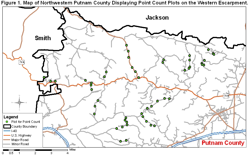
To see a map of western Putnam County displaying the point count plots where the following data were collected, go to this link:
Table 4. Cerulean Warblers counted at fifty 10-Minute Point Counts conducted in western Putnam County 5–8 June 2007. Points 1–14 were conducted 5 June; points 15–26 were conducted 6 June; points 27–39 were conducted 7 June; and points 40–50 were conducted 8 June.
| Point | Road Name | Pt. Code | Location |
Hab |
itat | # CERWs | Total | ||||
| No. | on Slope | All | Frag- | ||||||||
| Upper | Mid | Lower | Decid. | ment- | 1–3 Min. | 3–5 Min. | 5–10 Min. | ||||
| Forest | ed | ||||||||||
| 1 | Rt. 96 | AA1 | x | x | |||||||
| 2 | Rt. 96 | AA2 | x | x | 1 | 1 | 0 | 2 | |||
| 3 | Rt. 96 | AA3 | x | x | |||||||
| 4 | Rt. 96 | AA4 | x | x | |||||||
| 5 | Rt. 96 | AA5 | x | x | |||||||
| 6 | Rt. 96 | AA6 | x | x | |||||||
| 7 | Martin Creek Rd. | AA7 | x | x | |||||||
| 8 | Martin Creek Rd. | AA8 | x | x | 3 | 0 | 0 | 3 | |||
| 9 | Martin Creek Rd. | AA9 | x | x | 1 | 1 | 1 | 3 | |||
| 10 | Hopewell Rd. | TT4 | x | x | 0 | 1 | 0 | 1 | |||
| 11 | Hopewell Rd. | TT5 | x | x | |||||||
| 12 | Medley Hill Rd. | TT1 | x | x | |||||||
| 13 | Medley Hill Rd. | TT2 | x | x | |||||||
| 14 | Medley Hill Rd. | TT3 | x | x | |||||||
| 15 | Sullins Hollow Rd. | AA10 | x | x | 1 | 0 | 0 | 1 | |||
| 16 | Brindley Hollow Rd. | JJ2 | x | x | |||||||
| 17 | Brindley Hollow Rd. | JJ1 | x | x | |||||||
| 18 | Rock Springs Rd. | TT9 | x | x | |||||||
| 19 | Rock Springs Rd. | TT10 | x | x | |||||||
| 20 | Ensor Hollow Rd. | JJ3 | x | x | |||||||
| 21 | Ensor Hollow Rd. | JJ4 | x | x | 3 | 0 | 0 | 3 | |||
| 22 | Little Indian Cr. Rd. | JJ5 | x | x | |||||||
| 23 | Little Indian Cr. Rd. | JJ6 | x | x | 1 | 0 | 0 | 1 | |||
| 24 | Stanton Rd. | TT8 | x | x | |||||||
| 25 | Stanton Rd. | TT7 | x | x | |||||||
| 26 | Stanton Rd. | TT6 | x | x | |||||||
| 27 | Indian Creek Rd. | RR8 | x | x | |||||||
| 28 | Indian Creek Rd. | RR9 | x | x | |||||||
| 29 | Indian Creek Rd. | RR10 | x | x | |||||||
| 30 | Indian Creek Rd. | SS1 | x | x | |||||||
| 31 | Indian Creek Rd. | SS2 | x | x | |||||||
| 32 | Indian Creek Rd. | SS3 | x | x | |||||||
| 33 | Tightfit Rd. | SS4 | x | x | 1 | 0 | 2 | 3 | |||
| 34 | Tightfit Rd. | SS5 | x | x | 1 | 0 | 0 | 1 | |||
| 35 | Tightfit Rd. | SS6 | x | x | 0 | 0 | 1 | 1 | |||
| 36 | Tightfit Rd. | SS7 | x | x | |||||||
| 37 | Anderson-Carr Rd. | SS8 | x | x | |||||||
| 38 | Anderson-Carr Rd. | SS9 | x | x | 1 | 0 | 0 | 1 | |||
| 39 | Anderson-Carr Rd. | SS10 | x | x | 1 | 1 | 0 | 2 | |||
| 40 | Broadwater Br. Rd. | RR5 | x | x | |||||||
| 41 | Broadwater Br. Rd. | RR4 | x | x | 0 | 0 | 3 | 3 | |||
| 42 | Broadwater Br. Rd. | RR3 | x | x | 2 | 0 | 0 | 2 | |||
| 43 | Broadwater Br. Rd. | RR2 | x | x | 1 | 0 | 0 | 1 | |||
| 44 | Broadwater Br. Rd. | RR1 | x | x | |||||||
| 45 | Brown Hollow Rd. | JJ10 | x | x | 1 | 0 | 0 | 1 | |||
| 46 | Carrington Hol. Rd. | JJ9 | x | x | 1 | 0 | 1 | 2 | |||
| 47 | Carrington Hol. Rd. | JJ8 | x | x | 1 | 0 | 0 | 1 | |||
| 48 | Carrington Hol. Rd. | JJ7 | x | x | |||||||
| 49 | McBroom Br. Rd. | RR6 | x | x | 1 | 0 | 0 | 1 | |||
| 50 | McBroom Br. Rd. | RR7 | x | x | |||||||
| Totals | 50 | 16 | 19 | 15 | 16 | 34 | 21 | 4 | 8 | 33 |
Table 5. Cerulean Warblers counted at fifty 10-Minute Point Counts conducted in western Putnam County 4–11 June 2008. Points 1–14 were conducted 4 June; points 15–26 were conducted 9 June; points 27–39 were conducted 11 June; and points 40–50 were conducted 5 June.
| Stop | Road Name | Pt. Code | Location | Hab | itat | # CERWs | Total | ||||
| No. | on Slope | All | Frag- | ||||||||
| Upper | Mid | Lower | Dec. | ment- | 1–3 Min. | 3–5 Min. | 5–10 Min. | ||||
| Forest | ed | ||||||||||
| 1 | Rt. 96 | AA1 | x | x | |||||||
| 2 | Rt. 96 | AA2 | x | x | |||||||
| 3 | Rt. 96 | AA3 | x | x | |||||||
| 4 | Rt. 96 | AA4 | x | x | |||||||
| 5 | Rt. 96 | AA5 | x | x | |||||||
| 6 | Rt. 96 | AA6 | x | x | |||||||
| 7 | Martin Creek Rd. | AA7 | x | x | 0 | 0 | 1 | 1 | |||
| 8 | Martin Creek Rd. | AA8 | x | x | |||||||
| 9 | Martin Creek Rd. | AA9 | x | x | |||||||
| 10 | Hopewell Rd. | TT4 | x | x | 1 | 0 | 0 | 1 | |||
| 11 | Hopewell Rd. | TT5 | x | x | 0 | 1 | 0 | 1 | |||
| 12 | Medley Hill Rd. | TT1 | x | x | 1 | 0 | 0 | 1 | |||
| 13 | Medley Hill Rd. | TT2 | x | x | 0 | 1 | 0 | 1 | |||
| 14 | Medley Hill Rd. | TT3 | x | x | |||||||
| 15 | Sullins Hollow Rd. | AA10 | x | x | |||||||
| 16 | Brindley Hollow Rd. | JJ2 | x | x | |||||||
| 17 | Brindley Hollow Rd. | JJ1 | x | x | |||||||
| 18 | Rock Springs Rd. | TT9 | x | x | |||||||
| 19 | Rock Springs Rd. | TT10 | x | x | |||||||
| 20 | Ensor Hollow Rd. | JJ3 | x | x | |||||||
| 21 | Ensor Hollow Rd. | JJ4 | x | x | 0 | 1 | 0 | 1 | |||
| 22 | Little Indian Cr. Rd. | JJ5 | x | x | |||||||
| 23 | Little Indian Cr. Rd. | JJ6 | x | x | 0 | 0 | 1 | 1 | |||
| 24 | Stanton Rd. | TT8 | x | x | 1 | 0 | 0 | 1 | |||
| 25 | Stanton Rd. | TT7 | x | x | |||||||
| 26 | Stanton Rd. | TT6 | x | x | |||||||
| 27 | Indian Creek Rd. | RR8 | x | x | |||||||
| 28 | Indian Creek Rd. | RR9 | x | x | |||||||
| 29 | Indian Creek Rd. | RR10 | x | x | |||||||
| 30 | Indian Creek Rd. | SS1 | x | x | |||||||
| 31 | Indian Creek Rd. | SS2 | x | x | |||||||
| 32 | Indian Creek Rd. | SS3 | x | x | |||||||
| 33 | Tightfit Rd. | SS4 | x | x | 0 | 0 | 2 | 2 | |||
| 34 | Tightfit Rd. | SS5 | x | x | 0 | 0 | 1 | 1 | |||
| 35 | Tightfit Rd. | SS6 | x | x | |||||||
| 36 | Tightfit Rd. | SS7 | x | x | |||||||
| 37 | Anderson-Carr Rd. | SS8 | x | x | |||||||
| 38 | Anderson-Carr Rd. | SS9 | x | x | |||||||
| 39 | Anderson-Carr Rd. | SS10 | x | x | |||||||
| 40 | Broadwater Br. Rd. | RR5 | x | x | |||||||
| 41 | Broadwater Br. Rd. | RR4 | x | x | 2 | 0 | 0 | 2 | |||
| 42 | Broadwater Br. Rd. | RR3 | x | x | |||||||
| 43 | Broadwater Br. Rd. | RR2 | x | x | 2 | 0 | 0 | 2 | |||
| 44 | Broadwater Br. Rd. | RR1 | x | x | |||||||
| 45 | Brown Hollow Rd. | JJ10 | x | x | 3 | 0 | 0 | 3 | |||
| 46 | Carrington Hol. Rd. | JJ9 | x | x | 1 | 0 | 0 | 1 | |||
| 47 | Carrington Hol. Rd. | JJ8 | x | x | |||||||
| 48 | Carrington Hol. Rd. | JJ7 | x | x | 1 | 0 | 0 | 1 | |||
| 49 | McBroom Br. Rd. | RR6 | x | x | |||||||
| 50 | McBroom Br. Rd. | RR7 | x | x | |||||||
| Totals | 50 | 16 | 19 | 15 | 16 | 34 | 12 | 3 | 5 | 20 |
Table 6. Cerulean Warblers counted at fifty 10-Minute Point Counts conducted in western Putnam County 21–28 May 2009. Points 1–14 were conducted 21 May; points 15–26 were conducted 27 May; points 27–39 were conducted 26 May; and points 40–50 were conducted 28 May.
| Stop | Road Name | Pt. Code | Location | Hab | itat | # CERWs | Total | ||||
| No. | on Slope | All | Frag- | ||||||||
| Upper | Mid | Lower | Dec. | ment- | 1–3 Min. | 3–5 Min. | 5–10 Min. | ||||
| Forest | ed | ||||||||||
| 1 | Rt. 96 | AA1 | x | x | |||||||
| 2 | Rt. 96 | AA2 | x | x | |||||||
| 3 | Rt. 96 | AA3 | x | x | 1 | 0 | 0 | 1 | |||
| 4 | Rt. 96 | AA4 | x | x | |||||||
| 5 | Rt. 96 | AA5 | x | x | |||||||
| 6 | Rt. 96 | AA6 | x | x | |||||||
| 7 | Martin Creek Rd. | AA7 | x | x | |||||||
| 8 | Martin Creek Rd. | AA8 | x | x | 1 | 0 | 0 | 1 | |||
| 9 | Martin Creek Rd. | AA9 | x | x | 2 | 0 | 0 | 2 | |||
| 10 | Hopewell Rd. | TT4 | x | x | |||||||
| 11 | Hopewell Rd. | TT5 | x | x | 1 | 0 | 0 | 1 | |||
| 12 | Medley Hill Rd. | TT1 | x | x | |||||||
| 13 | Medley Hill Rd. | TT2 | x | x | 1 | 0 | 0 | 1 | |||
| 14 | Medley Hill Rd. | TT3 | x | x | |||||||
| 15 | Sullins Hollow Rd. | AA10 | x | x | |||||||
| 16 | Brindley Hollow Rd. | JJ2 | x | x | |||||||
| 17 | Brindley Hollow Rd. | JJ1 | x | x | |||||||
| 18 | Rock Springs Rd. | TT9 | x | x | 0 | 1 | 0 | 1 | |||
| 19 | Rock Springs Rd. | TT10 | x | x | |||||||
| 20 | Ensor Hollow Rd. | JJ3 | x | x | |||||||
| 21 | Ensor Hollow Rd. | JJ4 | x | x | 0 | 0 | 1 | 1 | |||
| 22 | Little Indian Cr. Rd. | JJ5 | x | x | |||||||
| 23 | Little Indian Cr. Rd. | JJ6 | x | x | |||||||
| 24 | Stanton Rd. | TT8 | x | x | 1 | 0 | 0 | 1 | |||
| 25 | Stanton Rd. | TT7 | x | x | 0 | 0 | 1 | 1 | |||
| 26 | Stanton Rd. | TT6 | x | x | |||||||
| 27 | Indian Creek Rd. | RR8 | x | x | |||||||
| 28 | Indian Creek Rd. | RR9 | x | x | |||||||
| 29 | Indian Creek Rd. | RR10 | x | x | 1 | 0 | 0 | 1 | |||
| 30 | Indian Creek Rd. | SS1 | x | x | |||||||
| 31 | Indian Creek Rd. | SS2 | x | x | 1 | 0 | 0 | 1 | |||
| 32 | Indian Creek Rd. | SS3 | x | x | 1 | 0 | 0 | 1 | |||
| 33 | Tightfit Rd. | SS4 | x | x | |||||||
| 34 | Tightfit Rd. | SS5 | x | x | 1 | 0 | 0 | 1 | |||
| 35 | Tightfit Rd. | SS6 | x | x | 0 | 0 | 1 | 1 | |||
| 36 | Tightfit Rd. | SS7 | x | x | |||||||
| 37 | Anderson-Carr Rd. | SS8 | x | x | |||||||
| 38 | Anderson-Carr Rd. | SS9 | x | x | 0 | 1 | 0 | 1 | |||
| 39 | Anderson-Carr Rd. | SS10 | x | x | 0 | 0 | 1 | 1 | |||
| 40 | Broadwater Br. Rd. | RR5 | x | x | |||||||
| 41 | Broadwater Br. Rd. | RR4 | x | x | 1 | 0 | 0 | 1 | |||
| 42 | Broadwater Br. Rd. | RR3 | x | x | |||||||
| 43 | Broadwater Br. Rd. | RR2 | x | x | 1 | 0 | 0 | 1 | |||
| 44 | Broadwater Br. Rd. | RR1 | x | x | 2 | 0 | 0 | 2 | |||
| 45 | Brown Hollow Rd. | JJ10 | x | x | 0 | 1 | 1 | 2 | |||
| 46 | Carrington Hol. Rd. | JJ9 | x | x | 1 | 0 | 0 | 1 | |||
| 47 | Carrington Hol. Rd. | JJ8 | x | x | |||||||
| 48 | Carrington Hol. Rd. | JJ7 | x | x | 1 | 0 | 0 | 1 | |||
| 49 | McBroom Br. Rd. | RR6 | x | x | |||||||
| 50 | McBroom Br. Rd. | RR7 | x | x | |||||||
| Totals | 50 | 16 | 19 | 15 | 16 | 34 | 17 | 3 | 5 | 25 |
Table 7. Cerulean Warblers counted at fifty 10-Minute Point Counts conducted in western Putnam County 22–25 May 2010. Points 1–14 were conducted 23 May; points 15–26 were conducted 25 May; points 27–39 were conducted 24 May; and points 40–50 were conducted 22 May.
| Stop | Road Name | Pt. Code | Location | Hab | itat | # CERWs | Total | ||||
| No. | on Slope | All | Frag- | ||||||||
| Upper | Mid | Lower | Dec. | ment- | 1–3 Min. | 3–5 Min. | 5–10 Min. | ||||
| Forest | ed | ||||||||||
| 1 | Rt. 96 | AA1 | x | x | |||||||
| 2 | Rt. 96 | AA2 | x | x | |||||||
| 3 | Rt. 96 | AA3 | x | x | 2 | 0 | 0 | 2 | |||
| 4 | Rt. 96 | AA4 | x | x | 1 | 0 | 0 | 1 | |||
| 5 | Rt. 96 | AA5 | x | x | |||||||
| 6 | Rt. 96 | AA6 | x | x | |||||||
| 7 | Martin Creek Rd. | AA7 | x | x | 1 | 0 | 0 | 1 | |||
| 8 | Martin Creek Rd. | AA8 | x | x | 1 | 0 | 0 | 1 | |||
| 9 | Martin Creek Rd. | AA9 | x | x | 1 | 1 | 0 | 2 | |||
| 10 | Hopewell Rd. | TT4 | x | x | 0 | 0 | 1 | 1 | |||
| 11 | Hopewell Rd. | TT5 | x | x | 2 | 0 | 0 | 2 | |||
| 12 | Medley Hill Rd. | TT1 | x | x | 0 | 0 | 1 | 1 | |||
| 13 | Medley Hill Rd. | TT2 | x | x | |||||||
| 14 | Medley Hill Rd. | TT3 | x | x | |||||||
| 15 | Sullins Hollow Rd. | AA10 | x | x | |||||||
| 16 | Brindley Hollow Rd. | JJ2 | x | x | |||||||
| 17 | Brindley Hollow Rd. | JJ1 | x | x | |||||||
| 18 | Rock Springs Rd. | TT9 | x | x | |||||||
| 19 | Rock Springs Rd. | TT10 | x | x | 0 | 1 | 0 | 1 | |||
| 20 | Ensor Hollow Rd. | JJ3 | x | x | |||||||
| 21 | Ensor Hollow Rd. | JJ4 | x | x | 1 | 1 | 0 | 2 | |||
| 22 | Little Indian Cr. Rd. | JJ5 | x | x | |||||||
| 23 | Little Indian Cr. Rd. | JJ6 | x | x | 1 | 0 | 0 | 1 | |||
| 24 | Stanton Rd. | TT8 | x | x | |||||||
| 25 | Stanton Rd. | TT7 | x | x | |||||||
| 26 | Stanton Rd. | TT6 | x | x | |||||||
| 27 | Indian Creek Rd. | RR8 | x | x | |||||||
| 28 | Indian Creek Rd. | RR9 | x | x | |||||||
| 29 | Indian Creek Rd. | RR10 | x | x | |||||||
| 30 | Indian Creek Rd. | SS1 | x | x | |||||||
| 31 | Indian Creek Rd. | SS2 | x | x | 1 | 0 | 0 | 1 | |||
| 32 | Indian Creek Rd. | SS3 | x | x | 1 | 2 | 0 | 3 | |||
| 33 | Tightfit Rd. | SS4 | x | x | |||||||
| 34 | Tightfit Rd. | SS5 | x | x | |||||||
| 35 | Tightfit Rd. | SS6 | x | x | 0 | 1 | 1 | 2 | |||
| 36 | Tightfit Rd. | SS7 | x | x | |||||||
| 37 | Anderson-Carr Rd. | SS8 | x | x | |||||||
| 38 | Anderson-Carr Rd. | SS9 | x | x | 1 | 0 | 0 | 1 | |||
| 39 | Anderson-Carr Rd. | SS10 | x | x | 1 | 0 | 0 | 1 | |||
| 40 | Broadwater Br. Rd. | RR5 | x | x | |||||||
| 41 | Broadwater Br. Rd. | RR4 | x | x | 0 | 2 | 0 | 2 | |||
| 42 | Broadwater Br. Rd. | RR3 | x | x | 1 | 0 | 1 | 2 | |||
| 43 | Broadwater Br. Rd. | RR2 | x | x | |||||||
| 44 | Broadwater Br. Rd. | RR1 | x | x | |||||||
| 45 | Brown Hollow Rd. | JJ10 | x | x | 0 | 1 | 0 | 1 | |||
| 46 | Carrington Hol. Rd. | JJ9 | x | x | 0 | 1 | 0 | 1 | |||
| 47 | Carrington Hol. Rd. | JJ8 | x | x | |||||||
| 48 | Carrington Hol. Rd. | JJ7 | x | x | |||||||
| 49 | McBroom Br. Rd. | RR6 | x | x | |||||||
| 50 | McBroom Br. Rd. | RR7 | x | x | |||||||
| Totals | 50 | 16 | 19 | 15 | 16 | 34 | 15 | 10 | 4 | 29 |
Table 8. Cerulean Warblers counted at fifty 10-Minute Point Counts conducted in western Putnam County 18–19 & 21–22 May 2011. Points 1–14 were conducted 22 May; points 15–26 were conducted 18 May; points 27–39 were conducted 19 May; and points 40–50 were conducted 22 May.
| Stop | Road Name | Pt. Code | Location | Hab | itat | # CERWs | Total | ||||
| No. | on Slope | All | Frag- | ||||||||
| Upper | Mid | Lower | Dec. | ment- | 1–3 Min. | 3–5 Min. | 5–10 Min. | ||||
| Forest | ed | ||||||||||
| 1 | Rt. 96 | AA1 | x | x | |||||||
| 2 | Rt. 96 | AA2 | x | x | |||||||
| 3 | Rt. 96 | AA3 | x | x | 0 | 0 | 1 | 1 | |||
| 4 | Rt. 96 | AA4 | x | x | |||||||
| 5 | Rt. 96 | AA5 | x | x | |||||||
| 6 | Rt. 96 | AA6 | x | x | |||||||
| 7 | Martin Creek Rd. | AA7 | x | x | 0 | 0 | 1 | 1 | |||
| 8 | Martin Creek Rd. | AA8 | x | x | |||||||
| 9 | Martin Creek Rd. | AA9 | x | x | 1 | 0 | 0 | 1 | |||
| 10 | Hopewell Rd. | TT4 | x | x | 1 | 0 | 0 | 1 | |||
| 11 | Hopewell Rd. | TT5 | x | x | 0 | 0 | 1 | 1 | |||
| 12 | Medley Hill Rd. | TT1 | x | x | |||||||
| 13 | Medley Hill Rd. | TT2 | x | x | 1 | 0 | 0 | 1 | |||
| 14 | Medley Hill Rd. | TT3 | x | x | |||||||
| 15 | Sullins Hollow Rd. | AA10 | x | x | |||||||
| 16 | Brindley Hollow Rd. | JJ2 | x | x | |||||||
| 17 | Brindley Hollow Rd. | JJ1 | x | x | |||||||
| 18 | Rock Springs Rd. | TT9 | x | x | 0 | 1 | 1 | 2 | |||
| 19 | Rock Springs Rd. | TT10 | x | x | |||||||
| 20 | Ensor Hollow Rd. | JJ3 | x | x | 1 | 0 | 0 | 1 | |||
| 21 | Ensor Hollow Rd. | JJ4 | x | x | 2 | 0 | 0 | 2 | |||
| 22 | Little Indian Cr. Rd. | JJ5 | x | x | |||||||
| 23 | Little Indian Cr. Rd. | JJ6 | x | x | |||||||
| 24 | Stanton Rd. | TT8 | x | x | |||||||
| 25 | Stanton Rd. | TT7 | x | x | |||||||
| 26 | Stanton Rd. | TT6 | x | x | |||||||
| 27 | Indian Creek Rd. | RR8 | x | x | |||||||
| 28 | Indian Creek Rd. | RR9 | x | x | |||||||
| 29 | Indian Creek Rd. | RR10 | x | x | |||||||
| 30 | Indian Creek Rd. | SS1 | x | x | |||||||
| 31 | Indian Creek Rd. | SS2 | x | x | 1 | 0 | 0 | 1 | |||
| 32 | Indian Creek Rd. | SS3 | x | x | 2 | 0 | 0 | 2 | |||
| 33 | Tightfit Rd. | SS4 | x | x | 1 | 0 | 0 | 1 | |||
| 34 | Tightfit Rd. | SS5 | x | x | |||||||
| 35 | Tightfit Rd. | SS6 | x | x | |||||||
| 36 | Tightfit Rd. | SS7 | x | x | |||||||
| 37 | Anderson-Carr Rd. | SS8 | x | x | |||||||
| 38 | Anderson-Carr Rd. | SS9 | x | x | |||||||
| 39 | Anderson-Carr Rd. | SS10 | x | x | 1 | 1 | 1 | 3 | |||
| 40 | Broadwater Br. Rd. | RR5 | x | x | 1 | 0 | 0 | 1 | |||
| 41 | Broadwater Br. Rd. | RR4 | x | x | |||||||
| 42 | Broadwater Br. Rd. | RR3 | x | x | 0 | 0 | 1 | 1 | |||
| 43 | Broadwater Br. Rd. | RR2 | x | x | 0 | 0 | 1 | 1 | |||
| 44 | Broadwater Br. Rd. | RR1 | x | x | |||||||
| 45 | Brown Hollow Rd. | JJ10 | x | x | 1 | 0 | 1 | 2 | |||
| 46 | Carrington Hol. Rd. | JJ9 | x | x | 1 | 0 | 0 | 1 | |||
| 47 | Carrington Hol. Rd. | JJ8 | x | x | |||||||
| 48 | Carrington Hol. Rd. | JJ7 | x | x | |||||||
| 49 | McBroom Br. Rd. | RR6 | x | x | 0 | 1 | 0 | 1 | |||
| 50 | McBroom Br. Rd. | RR7 | x | x | |||||||
| Totals | 50 | 16 | 19 | 15 | 16 | 34 | 14 | 3 | 8 | 25 |
Table 9. Cerulean Warblers counted at fifty 10-Minute Point Counts conducted in western Putnam County 19–26 May 2012. Points 1–14 were conducted 26 May; points 15–26 were conducted 19 May; points 27–39 were conducted 25 May; and points 40–50 were conducted 23 May.
| Stop | Road Name | Pt. Code | Location | Hab | itat | # CERWs | Total | ||||
| No. | on Slope | All | Frag- | ||||||||
| Upper | Mid | Lower | Dec. | ment- | 1–3 Min. | 3–5 Min. | 5–10 Min. | ||||
| Forest | ed | ||||||||||
| 1 | Rt. 96 | AA1 | x | x | |||||||
| 2 | Rt. 96 | AA2 | x | x | |||||||
| 3 | Rt. 96 | AA3 | x | x | 1 | 0 | 0 | 1 | |||
| 4 | Rt. 96 | AA4 | x | x | |||||||
| 5 | Rt. 96 | AA5 | x | x | |||||||
| 6 | Rt. 96 | AA6 | x | x | |||||||
| 7 | Martin Creek Rd. | AA7 | x | x | 0 | 1 | 0 | 1 | |||
| 8 | Martin Creek Rd. | AA8 | x | x | |||||||
| 9 | Martin Creek Rd. | AA9 | x | x | 1 | 0 | 0 | 1 | |||
| 10 | Hopewell Rd. | TT4 | x | x | 0 | 0 | 1 | 1 | |||
| 11 | Hopewell Rd. | TT5 | x | x | 3 | 0 | 0 | 3 | |||
| 12 | Medley Hill Rd. | TT1 | x | x | 1 | 0 | 0 | 1 | |||
| 13 | Medley Hill Rd. | TT2 | x | x | 1 | 0 | 0 | 1 | |||
| 14 | Medley Hill Rd. | TT3 | x | x | |||||||
| 15 | Sullins Hollow Rd. | AA10 | x | x | |||||||
| 16 | Brindley Hollow Rd. | JJ2 | x | x | |||||||
| 17 | Brindley Hollow Rd. | JJ1 | x | x | |||||||
| 18 | Rock Springs Rd. | TT9 | x | x | 1 | 0 | 0 | 1 | |||
| 19 | Rock Springs Rd. | TT10 | x | x | 1 | 0 | 0 | 1 | |||
| 20 | Ensor Hollow Rd. | JJ3 | x | x | 1 | 0 | 0 | 1 | |||
| 21 | Ensor Hollow Rd. | JJ4 | x | x | 3 | 0 | 0 | 3 | |||
| 22 | Little Indian Cr. Rd. | JJ5 | x | x | |||||||
| 23 | Little Indian Cr. Rd. | JJ6 | x | x | 1 | 0 | 1 | 2 | |||
| 24 | Stanton Rd. | TT8 | x | x | |||||||
| 25 | Stanton Rd. | TT7 | x | x | |||||||
| 26 | Stanton Rd. | TT6 | x | x | |||||||
| 27 | Indian Creek Rd. | RR8 | x | x | 0 | 0 | 1 | 1 | |||
| 28 | Indian Creek Rd. | RR9 | x | x | |||||||
| 29 | Indian Creek Rd. | RR10 | x | x | |||||||
| 30 | Indian Creek Rd. | SS1 | x | x | 1 | 0 | 0 | 1 | |||
| 31 | Indian Creek Rd. | SS2 | x | x | |||||||
| 32 | Indian Creek Rd. | SS3 | x | x | 0 | 0 | 1 | 1 | |||
| 33 | Tightfit Rd. | SS4 | x | x | 2 | 0 | 0 | 2 | |||
| 34 | Tightfit Rd. | SS5 | x | x | 1 | 0 | 0 | 1 | |||
| 35 | Tightfit Rd. | SS6 | x | x | 0 | 1 | 0 | 1 | |||
| 36 | Tightfit Rd. | SS7 | x | x | 0 | 0 | 1 | 1 | |||
| 37 | Anderson-Carr Rd. | SS8 | x | x | 1 | 0 | 0 | 1 | |||
| 38 | Anderson-Carr Rd. | SS9 | x | x | |||||||
| 39 | Anderson-Carr Rd. | SS10 | x | x | |||||||
| 40 | Broadwater Br. Rd. | RR5 | x | x | 1 | 0 | 0 | 1 | |||
| 41 | Broadwater Br. Rd. | RR4 | x | x | |||||||
| 42 | Broadwater Br. Rd. | RR3 | x | x | 1 | 0 | 0 | 1 | |||
| 43 | Broadwater Br. Rd. | RR2 | x | x | |||||||
| 44 | Broadwater Br. Rd. | RR1 | x | x | |||||||
| 45 | Brown Hollow Rd. | JJ10 | x | x | |||||||
| 46 | Carrington Hol. Rd. | JJ9 | x | x | 2 | 0 | 0 | 2 | |||
| 47 | Carrington Hol. Rd. | JJ8 | x | x | 0 | 0 | 1 | 1 | |||
| 48 | Carrington Hol. Rd. | JJ7 | x | x | |||||||
| 49 | McBroom Br. Rd. | RR6 | x | x | 2 | 0 | 0 | 2 | |||
| 50 | McBroom Br. Rd. | RR7 | x | x | 1 | 0 | 1 | 2 | |||
| Totals | 50 | 16 | 19 | 15 | 16 | 34 | 26 | 2 | 7 | 35 |
Quick links to other sections of this website: